Traffic Data Collections

Traffic Data Collections
.png)
Automatic Traffic Counter and Classifier (ATCC)
Our Automatic Traffic Counter and Classifiers (ATCC) accurately count vehicles by class using various road sensors. As authorized distributors of Metrocount, the world’s leading ATCC manufacturer, we guarantee maximum accuracy in your surveys. . enforcing regulations, and improving road safety. • Transport Department Audits: Facilitates thorough evaluations and audits of transportation infrastructure and operations. • Detailed Project Reports (DPRs): Assists in generating accurate and comprehensive DPRs for road construction and upgrades. • Toll Plaza Audits: Ensures the integrity of toll collection processes and operational efficiency. • Smart City Projects: Enhances urban traffic management systems, contributing to the development of smarter and more efficient cities. Utilizing non-intrusive technologies such as video/photo-based methods, infrared sensors, and pneumatic tubes, our ATCC system delivers precise vehicle classification and counting. This robust technology offers valuable insights into vehicle types and traffic patterns, essential for optimizing congestion control and strategic infrastructure planning.
.png)
Video Based Traffic Survey (ANPR):
We conduct comprehensive video traffic surveys across India using advanced technology, including vehicle axle clear systems and Automatic Number Plate Recognition (ANPR). Our long-range infrared cameras and solid-state digital recording ensure the highest levels of data integrity and traceability. .
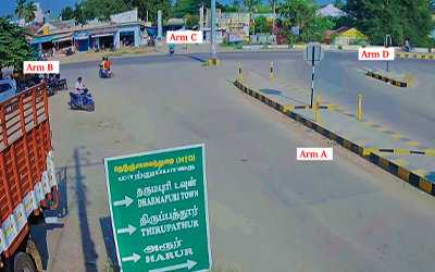
Turning Movement Count
we utilize advanced camera technology to record video for our Turning Movement Count surveys. In this survey, we capture the turning movements of automobiles at intersections. . The data collected is used for various purposes, including improving junction design, planning zebra crossings for pedestrians, and optimizing signal timing. We provide detailed insights, including peak hour data, and administer this survey using a video-based approach.
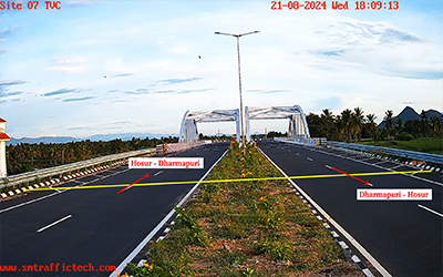
Link and Midblock Counts
Understanding traffic volume and vehicle class composition on any roadway is essential for strategic planning, improvements, and maintenance. This data helps determine key metrics like Average Daily Traffic (ADT) and Peak Hour Traffic (PHT). . We also employ video technology to survey and analyze roadway volume and vehicle classification, providing accurate and up-to-date data, including the Federal Highway Administration (FHWA) 13-category vehicle classification. This comprehensive approach enables better decision-making for optimizing traffic flow, enhancing safety, and planning future infrastructure developments.
Roundabout Data Processing
we transform videos of roundabouts into accurate traffic data. Whether the roundabout is signalized or non-signalized, and recorded with a single camera or multiple cameras, we deliver precise analysis. We can accommodate roundabouts with 3, 4, 5, or 6 arms, whether they are regular or staggered. Our classifications range from total volume counts to customized vehicle classes, and we can provide data with or without crosswalk information. Our team is fully equipped to process data from roundabouts filmed with multiple cameras, and we offer TMC data by tracking vehicles from various angles
Pedestrian Survey
we set up cameras at selected locations to record video footage that determines pedestrian flow through junctions, across roads, or along footpaths. This survey is conducted to inform decisions regarding the appropriate extensions and standards for pedestrian facilities, such as zebra crossings, pedestrian subways, pedestrian bridges, and footpath improvements. .
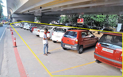
Parking Survey
our Parking Surveys utilize both video recordings and manual observations. The objective of this study is to assess parking patterns, primarily in commercial areas We conduct parking surveys for both on-road and off-road locations. This study provides valuable insights into parking duration, instances of illegal parking, and other relevant details.
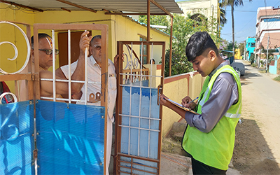
Household Surveys
Household surveys are conducted through direct, manual data collection by enumera-tors who visit each residence within a designated area. This method provides compre-hensive insights into various aspects of the community, including living standards, infrastructure conditions, available facilities, metro stations, bus stops, transportation habits, and demographic information. The survey aims to thoroughly assess the socio-economic and environmental conditions of the area, offering valuable data to guide policy decisions, resource allocation, and development planning.
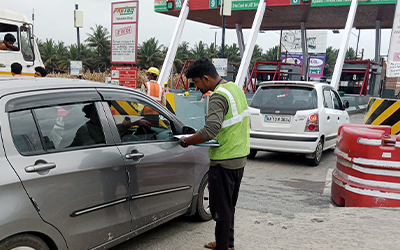
Roadside Interviews
our expert team excels in conducting roadside interviews across various locations, in-cluding major motorways, slip roads, service areas, and intersections throughout India. With extensive experience in managing high traffic volumes and complex conditions, we specialize in developing innovative solutions tailored to both national and regional roadways. . Our primary objective is to gather detailed data on traffic volumes, mobility patterns, and travel behaviors within the study area. This essential information aids in crafting strategies to meet future transportation needs and provides accurate traffic flow pro-jections. By leveraging real-time data, our comprehensive approach ensures that transportation planning is effective and forward-looking, facilitating efficient traffic management solutions.
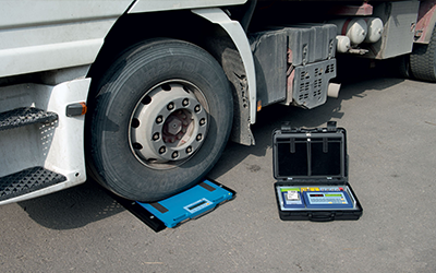
Axle Load Survey
Axle load surveys are essential for assessing road damage caused by heavy traffic. These surveys provide valuable data on average pavement loading, aiding authorities and civil engineering firms in road management and pavement design. . We utilize both static and dynamic methods to measure axle loads and gross vehicle weights. This includes using Essae axle/wheel weighing pads for accurate static measurements.
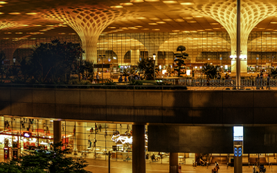
Airport Survey
We conduct detailed surveys at airports, collecting data on boarding and alighting activities for trains, pedestrian traffic on platforms and in subways, drop-off and pick-up processes at entrances, and waiting times for taxis and private cars. Additionally, we monitor shuttle bus services and other relevant activities. . This comprehensive information provides valuable insights into airport operations and passenger flow, supporting effective planning and management.
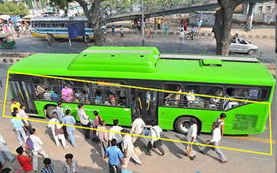
Bus Survey
Using video footage, we monitor bus arrival and departure times, as well as boarding and alighting counts categorized by gender and age. We also track bus service numbers and vehicle classifications, including different types of buses and their capacities. . Additionally, we provide detailed insights tailored to client requirements, offering a comprehensive view of bus station operations and passenger demographics. This data supports effective planning and management of bus services and station facilities.
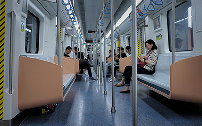
Public Transport Counts Analysis
Our advanced Public Transport Counts Analysis system offers unparalleled precision in tracking passenger movements using sophisticated video and intelligent people counters. Achieving a 98% accuracy rate, our system outperforms traditional manual counting, which often has a 15% error margin. . . It effectively distinguishes between adults, children, bicycles, and luggage, providing detailed insights into boarding and alighting patterns. Why Count Public Transport Passengers? • Increase Fare Revenue: Enhanced accuracy in ticket-passenger comparisons can significantly boost fare revenue, often covering the cost of the system. • Informed Decision-Making: Utilize comprehensive data for better scheduling, forecasting, and service planning. • Performance Metrics: Analyze key performance indicators such as cost per passenger and passengers per mile. • Monitor Stop Times: Track passenger wait times at each stop to improve operational efficiency. • Track Trends: Observe changes in passenger numbers to adjust services according to demand. • Secure Grants: Use reliable data to support funding applications and justify investments. Our system also provides real-time occupancy counts through various interfaces, including meters, smartphones, web browsers, and IoT devices. It tracks passenger flow, monitors queues, generates occupancy graphs, and creates activity hotspot maps to highlight high-traffic areas and measure foot traffic in retail spaces at stations. This comprehensive analysis ensures improved public transport services and operational efficiency.
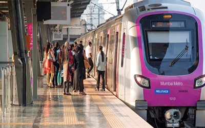
Metro Survey
We conduct detailed surveys at metro stations, capturing essential data such as boarding and alighting information for trains, pedestrian activity on platforms and in subways, and drop-off/pick-up operations at station entrances. We also monitor waiting times for taxis and private cars, as well as gather information on shuttle bus services. This comprehensive data provides valuable insights into metro station operations and passenger behavior, facilitating effective planning and management.
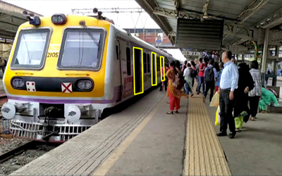
Railway Station Survey
We conduct detailed surveys at railway stations, capturing a wide range of information, including boarding and alighting data for trains, pedestrian activity on platforms and in subways, drop-off and pick-up activities at station entrances, waiting times for taxis and private cars, and shuttle bus information This comprehensive data collection provides valuable insights into station operations and passenger behavior, supporting improved planning and management.
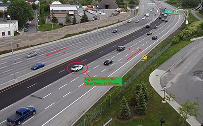
Speed & Delay Survey
Our Speed & Delay Survey aims to analyze journey times, vehicle speeds, and types of delays within the road network. We typically conduct this survey during peak hours for both directions, collecting data on traffic flow across the entire road system . This study also provides incidental observations, such as traffic jams, accidents, delays caused by signals, and instances of pedestrians crossing outside designated areas. These insights are invaluable for understanding and improving traffic management.